VRT Uses POSPac to Improve Underwater Inspection Surveys
Underwater mapping despite low visibility in Finnish lakes
Solution:
- POS MV blends GNSS data with angular rate and acceleration data from an IMU and heading from GAMS to produce a robust and accurate solution
- POSPac Mobile Mapping Suite is industry-leading software for Direct Georeferencing of mobile mapping sensors using GNSS and inertial technology.
Overview
Faced with the regular challenge of harsh GNSS environments, VRT needed a solution that could provide robust positioning and orientation to aid in their underwater inspections.
SOLUTION
VRT partnered with Applanix to design the perfect solution. VRT has two survey vessels that use Applanix POS MV to produce position and orientation solution.
In addition, VRT uses POSPac post-processing software to ensure the best quality data is achieved. Specifically, the IN-Fusion SmartBase and IN-Fusion SingleBase processing methods are used to improve the position and orientation solution, allowing noise point filtering and manual cleaning to become easier and more efficient.

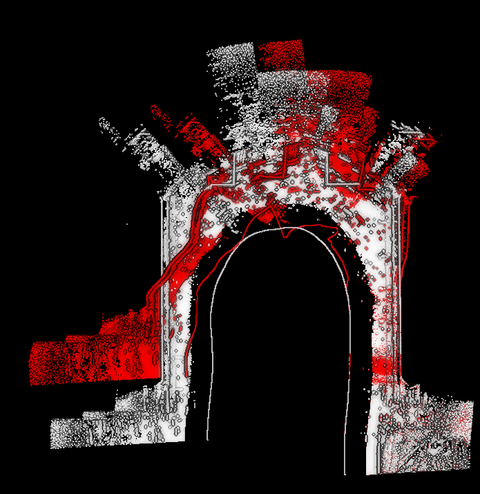
POSPac is used to improve the solution in harsh GNSS environments. The white points show the improved processed solution, whilst the raw, red points show the real-time solution.
If the survey area is accessible by the surveys vessels, VRT has 100 per cent confidence that POSPac provides the high quality data needed for inspection.
Even in extreme GNSS-environments like in urban canyons or beneath the bridge where GNSS data is completely lost for some time, POSPac has always made it possible to save the data.
“The improved data quality helps inspectors to make better observations and to be more confident about the information,” says Ville Mäkeläinen, Chief Business Development Officer at VRT.